Zone-based asset tracking solves the problem GPS can't: knowing where your equipment is when it's inside a building, sitting in a crowded yard, or spread across a multi-building campus. Instead of latitude and longitude (useless indoors), you get operational context — which named zone each asset occupies, 24/7, in terms your team already uses.
This guide covers how zone-based tracking works, how it compares to GPS and traditional Bluetooth solutions, which industries benefit most, and what to look for when evaluating systems.
Last updated: February 2026
Key Takeaways
- Zone-based tracking divides physical spaces into named areas and monitors which assets are in which zone — answering "where is it?" in operational terms, not coordinates.
- Fixed, cellular-connected gateways provide 24/7 coverage — unlike vehicle-dependent BLE tags that go dark when trucks leave the site (the "dark tag" problem).
- BLE tags at $5–$30 per device make it cost-effective to track mid-value assets ($500–$5,000) that fall below the GPS cost threshold of $8–$15/month.
- Data centers, large construction sites, and equipment rental yards are the highest-value applications — environments where GPS is blind and RTLS is overkill.
How Zone-Based Tracking Works
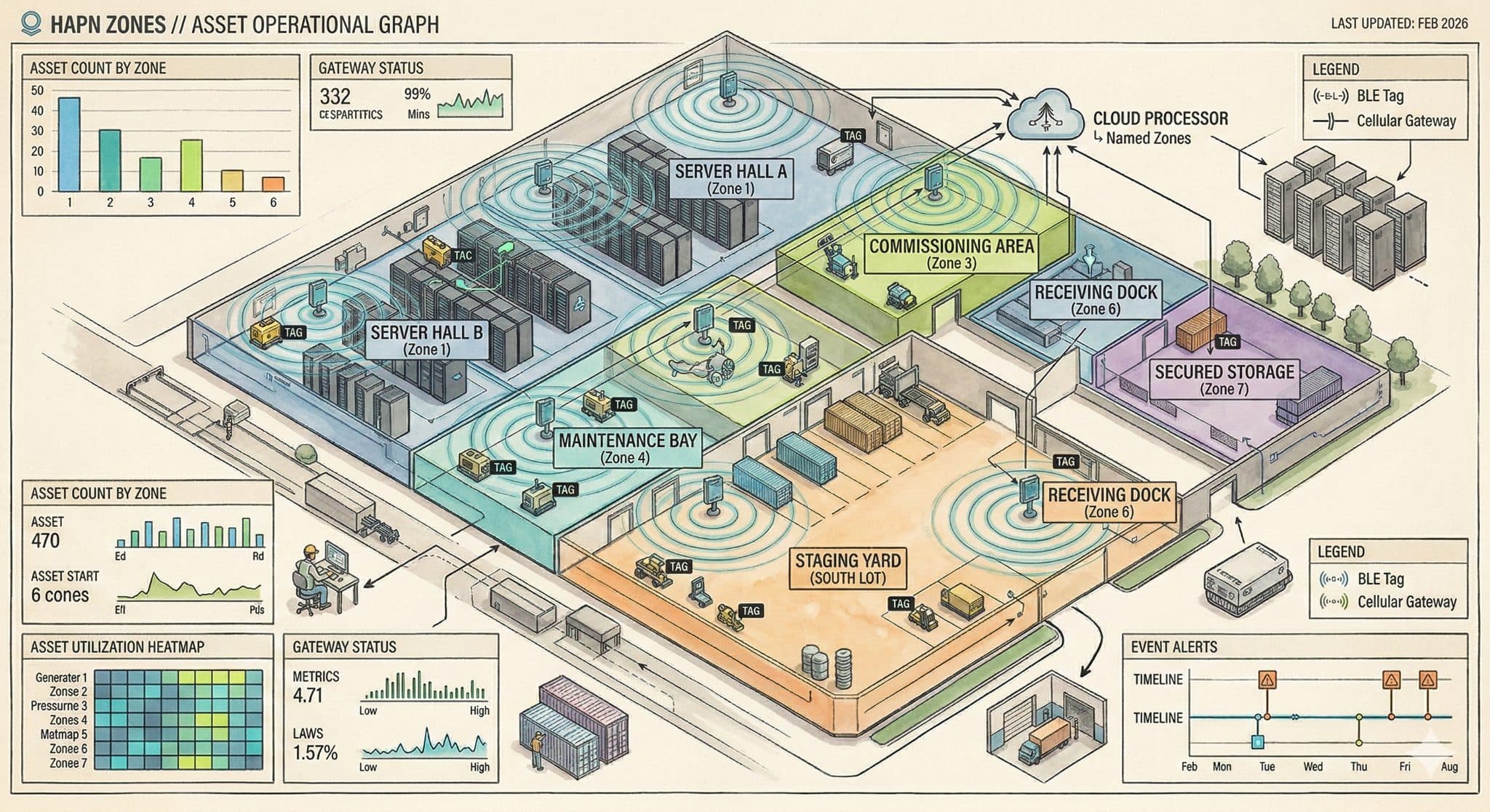
Zone-based tracking uses a network of fixed reference points — typically wireless gateways — installed throughout a site. Each gateway creates a sensing radius. Small, battery-powered tags attached to assets broadcast signals that these gateways detect. Software then determines which zone each asset occupies based on signal characteristics.
The simplest implementations use proximity: if Gateway #3 detects a tag, the asset is considered "near Gateway #3." More advanced systems use machine learning to classify signals and assign assets to specific named zones — accounting for signal reflections off metal structures, concrete walls, and other environmental factors that would confuse basic signal-strength readings.
Key difference from GPS
Zone-based tracking doesn't try to pinpoint an asset to a set of coordinates. It answers the question operations teams actually ask: "Is the generator in Staging or did someone move it to the south lot?"
The Components of a Zone-Based System
A typical zone-based asset tracking deployment includes three layers:
Tags: Small Bluetooth Low Energy (BLE) devices attached to each asset. Modern tags cost between $5 and $30 depending on the vendor, run on coin-cell or AA batteries lasting one to five years, and often include accelerometers to detect movement. Tags broadcast a signal at regular intervals — anywhere from every few seconds to every few minutes, depending on configuration.
Gateways (or anchors): Fixed devices installed at known positions throughout a site. These receive tag signals and relay the data to the cloud. The connectivity method matters significantly — gateways that require Wi-Fi or Ethernet limit where you can deploy them, while cellular-connected gateways work anywhere with cell coverage. A typical site uses four to eight gateways to cover a facility or yard.
Software platform: The cloud layer that processes signal data, assigns zone locations, maintains history, and generates alerts. This is where zone definitions live — the software maps signal patterns to zone names that match your operational layout.
Zone-Based Tracking vs. GPS: Different Tools for Different Problems
GPS tracking dominates fleet management for good reason — it's excellent at tracking vehicles moving between locations on public roads. But GPS has fundamental limitations that zone-based tracking addresses.
GPS doesn't work indoors. GPS signals require line-of-sight to satellites. Inside steel-frame buildings, underground parking structures, warehouses, and data center halls, GPS accuracy degrades from meters to "no signal." This isn't a technology limitation that's being solved — it's physics.
GPS is too expensive for mid-value assets. A cellular GPS tracker costs $8 to $15 per month per device, plus hardware. That's justifiable for a $200,000 excavator but not for a $500 pressure washer, a $2,000 generator, or a $300 set of scaffolding frames. Most job sites have hundreds of these mid-value assets that fall below the GPS cost threshold.
GPS gives coordinates, not context. A set of coordinates means little inside a 50-acre construction site with multiple buildings and laydown areas. Telling a superintendent that Generator #47 is at 36.1627° N, 115.1489° W is less useful than telling them it's in the Staging Zone on the north side of Building C.
| Capability | GPS Tracking | Zone-Based Tracking |
|---|---|---|
| Indoor Coverage | No (signals blocked by steel/concrete) | Yes (BLE signals work indoors) |
| Accuracy Type | Precise coordinates (3–15m outdoors) | Named zone (operational context) |
| Cost per Device | $8–$15/month + hardware | $5–$30 tag + shared gateway cost |
| Best For | Vehicles on roads, high-value mobile assets | Indoor assets, yards, mid-value equipment |
| 24/7 Coverage | Yes (cellular built-in) | Depends — fixed gateways: yes; vehicle-dependent: no |
| Infrastructure Needed | None (satellite-based) | 4–8 gateways per site |
The "Dark Tag" Problem: Why Most Bluetooth Tracking Falls Short
Many fleet telematics companies — Samsara, Tenna, Geotab, and others — offer BLE tags as add-ons to their vehicle tracking platforms. The concept sounds reasonable: attach a BLE tag to an asset, and when a company vehicle drives past, the vehicle's gateway picks up the tag signal and reports its location.
The problem is what happens when no vehicle is nearby.
The 60-Hour Blind Spot
When the last truck leaves a job site at 5 PM on Friday, every vehicle-dependent BLE tag on that site goes dark. No vehicles means no gateways. No gateways means no location updates. If equipment is stolen Saturday morning, you won't know until Monday — and the "last known location" is wherever a truck happened to drive past it on Friday afternoon.
This is the fundamental architecture problem that zone-based systems with fixed, always-on gateways solve. Cellular-connected gateways don't depend on vehicles or phones. They sense continuously — 24 hours a day, 7 days a week — whether anyone is on-site or not.
How Machine Learning Improves Zone Accuracy
Basic zone-based tracking uses received signal strength indication (RSSI) to estimate proximity: stronger signal means closer to the gateway. This works in open-air environments but breaks down in real-world industrial settings.
Construction sites, data centers, and warehouses are filled with metal, concrete, and heavy equipment. These materials reflect and absorb Bluetooth signals unpredictably. A tag 10 meters away might read a stronger signal than one 5 meters away because of a metal container reflecting the signal.
Machine learning-based zone classification takes a different approach. Instead of fighting signal reflections, ML models learn the unique signal fingerprint of each zone — including the multipath reflections, interference patterns, and environmental noise that characterize that specific location. The system trains on site-specific data during a brief calibration period, then continuously classifies incoming signals against those learned patterns.
Additional sensor data improves accuracy further. Tags with built-in accelerometers can detect whether an asset is stationary or in motion, adding a second classification layer. If a tag's signal suggests it might be between two zones, but the accelerometer shows no movement in 12 hours, the system maintains the last confident zone assignment rather than bouncing between zones.
See Zone-Based Tracking in Action
Hapn Zones uses ML-trained classification and cellular gateways for always-on, 24/7 asset visibility — no WiFi or IT required.
Get Pricing →Key Industries for Zone-Based Asset Tracking
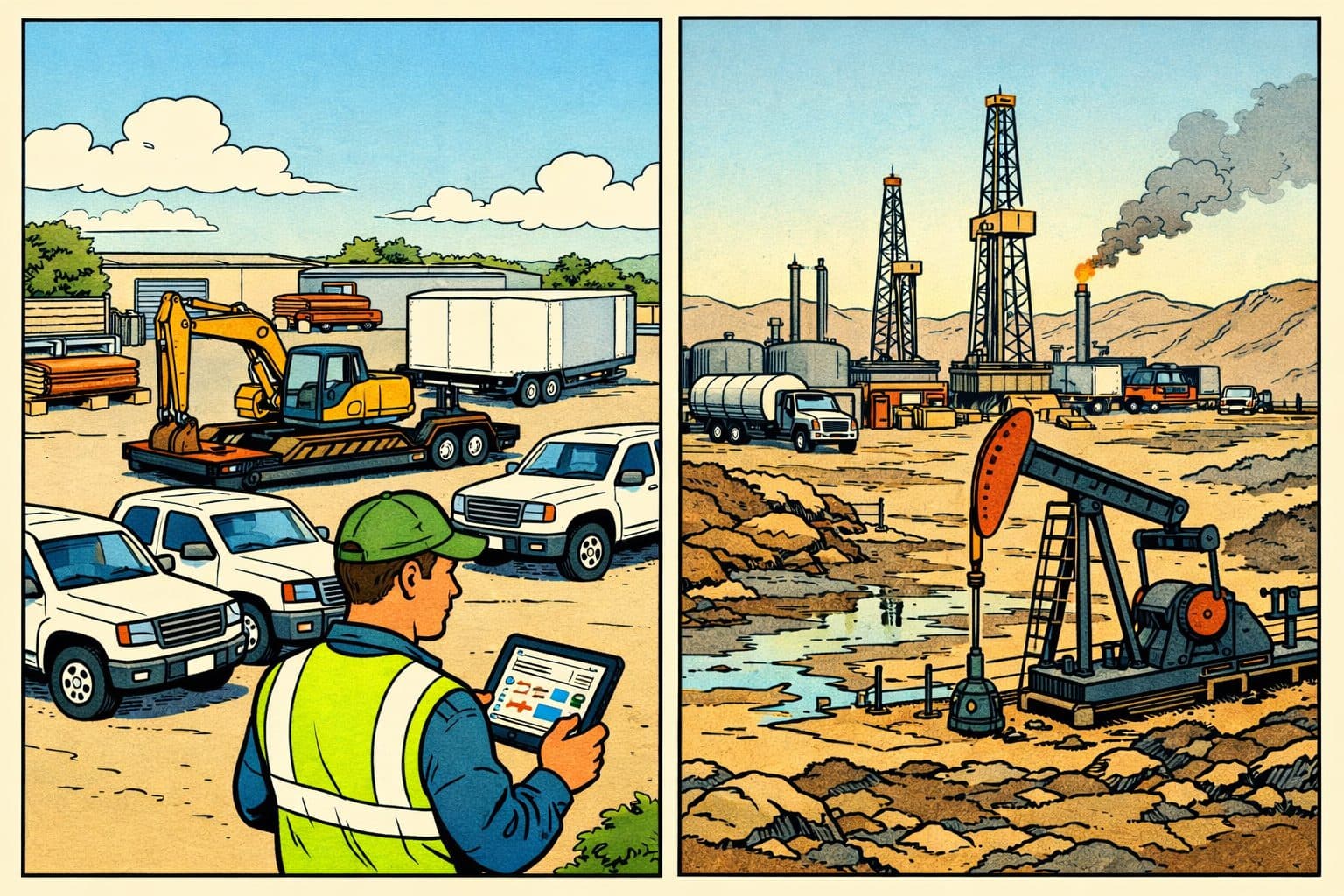
Data Center Construction
Data centers present a near-perfect use case for zone-based tracking. These facilities are steel-and-concrete shells where GPS is completely blind. Builds span two to five years with thousands of assets flowing through from dozens of subcontractors. The value density is enormous — servers, PDUs, cable trays, and specialized cooling equipment worth millions pass through staging, installation, and commissioning zones.
U.S. data center construction spending ranges from $14 billion to $48 billion annually, driven by AI infrastructure demand, and is growing 8 to 15 percent per year. Zone-based tracking maps directly to how data center projects are organized: receiving docks, staging areas, hot aisles, cold aisles, and commissioning zones.
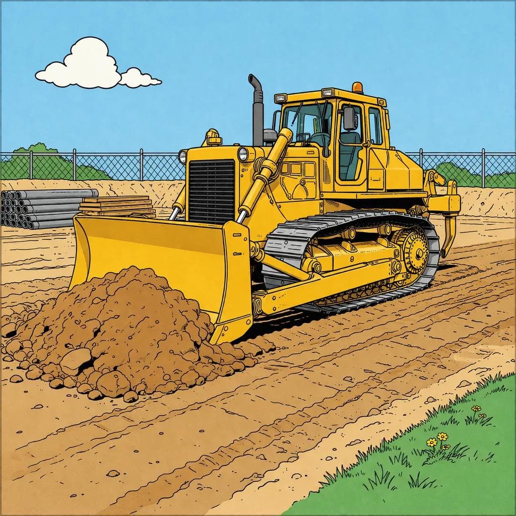
Large Construction Sites
Commercial, infrastructure, and industrial job sites are sprawling environments with well-defined operational zones: laydown yards, staging areas, active work zones, tool cribs, and secured storage. Superintendents already draw these zones on site logistics plans — zone-based tracking digitizes what's already in their heads.
Equipment theft costs the construction industry between $300 million and $1 billion annually, with average incidents around $30,000 and recovery rates under 25 percent. Workers waste an estimated 1.5 hours per day searching for misplaced tools and equipment — at loaded labor costs of $50 to $70 per hour, that's $3,750 to $5,250 per worker per year.
Equipment Rental Yards
Rental yards may be the highest-volume, lowest-friction opportunity for zone-based tracking. A typical rental branch manages hundreds of attachments, small equipment, and tools across outdoor lots and covered storage areas.
Zone names map directly to rental operations: "Ready for Pickup," "Staging," "Maintenance," "Returned — Needs Inspection." The U.S. equipment rental industry hit $84 billion in 2024, with rental penetration at a record 57 percent. As rental fleets grow and turn faster, manual yard management becomes the bottleneck.
Warehouses and Distribution Centers
Indoor warehouses with defined zones — receiving, storage aisles, packing, shipping — benefit from always-on zone visibility without the cost and complexity of enterprise RTLS. Zone-based tracking sits between barcode scanning (accurate but requires manual labor) and enterprise RTLS (automated but costs $50,000–$500,000+ to deploy).
What to Look For When Evaluating Zone-Based Systems
Always-On vs. Vehicle-Dependent
This is the single most important criterion. Ask the vendor: "If no vehicles or phones are on my site for 48 hours, will my assets still report their locations?" If the answer involves vehicles, phones, or worker apps, you're looking at a system with the dark tag problem. Fixed gateways with cellular connectivity are the only architecture that provides persistent 24/7 coverage.
Zone Granularity
How many distinct zones can the system resolve? Basic proximity systems give you one zone per gateway — if you have six gateways, you get six zones. ML-based systems can resolve more zones than gateways by learning the signal characteristics of each area.
Connectivity Requirements
Does the system require Wi-Fi on site? Most construction sites and rental yards don't have managed Wi-Fi networks. Systems that require Wi-Fi for gateway connectivity are immediately limited to finished facilities. Cellular-connected gateways eliminate this dependency entirely.
Total Cost of Ownership
Compare the full stack: tag cost, gateway cost, monthly subscription, and installation. Key benchmarks: BLE tags range from $5 to $150. Gateways range from $100 to $500+. Monthly per-tag fees range from free (hardware-only models) to $8+ per month. Calculate the cost for your specific scenario — say, 200 tags across a site with 6 gateways.
Deployment Complexity
How long does it take to go from unboxing to operational? Enterprise RTLS requires weeks of RF surveying and professional installation. The best zone-based systems can be deployed in hours by operations staff — no network engineers or IT involvement required.
Integration with Existing Systems
Does the zone tracking platform integrate with your existing fleet management, ERP, or operations software via API? Zone data is most valuable when it flows into the systems your team already uses rather than living in a separate dashboard.
Zone-Based Tracking vs. RTLS
Enterprise RTLS — from vendors like Zebra, Quuppa, and Cisco — delivers centimeter-to-sub-meter precision using Ultra-Wideband (UWB) or BLE Angle-of-Arrival. These systems are designed for hospitals and automated warehouses where precise coordinates drive automation.
For most construction, rental, and logistics operations, RTLS is overkill on three dimensions:
| Factor | Enterprise RTLS | Zone-Based Tracking |
|---|---|---|
| Deployment Cost | $50,000–$500,000+ infrastructure | 4–8 gateways at ~$100 each + $5–$30 tags |
| Infrastructure | PoE Ethernet cabling to every anchor | Plug gateways into any 110V outlet |
| IT Involvement | RF surveys, network engineering, ongoing IT support | Self-deploy in hours, zero IT dependency |
| Accuracy | Centimeter-to-meter coordinates | Named zone (e.g., "Staging," "Hall B Row 14") |
| Best Fit | Hospitals, automated warehouses | Construction, data centers, rental yards |
Zone-based tracking accepts a trade-off: zone-level accuracy instead of coordinate-level. For operations decisions — "is this generator in Staging or on the south lot?" — zone-level accuracy is sufficient, and the cost, deployment, and infrastructure advantages are enormous.
The Future of Zone-Based Tracking
Hybrid BLE + UWB: Next-generation systems are adding on-demand Ultra-Wideband capability to BLE-based zone tracking. The BLE layer provides continuous, low-power zone monitoring. When you need to find a specific asset within a zone, UWB activates to provide meter-level "find it" precision.
AI-powered anomaly detection: As zone-based systems accumulate movement history, machine learning models can identify unusual patterns — an asset stationary longer than normal, equipment that moved outside business hours, or utilization patterns suggesting underuse.
Predictive maintenance triggers: When zone data combines with accelerometer and usage patterns, systems can flag assets that may need maintenance based on actual activity rather than arbitrary time intervals.
Getting Started with Zone-Based Tracking
If you're evaluating zone-based tracking for your operation, start with a single high-value site — the location where asset visibility gaps cause the most pain. Define the zones that match how your team already thinks about the space. Deploy a pilot with enough tags to cover your highest-value or most frequently misplaced asset categories.
The ROI calculation is straightforward: compare the annual cost of the tracking system against the cost of one theft incident ($30,000 average), the labor hours spent searching for equipment ($3,750–$5,250 per worker per year), or the utilization improvement from better asset visibility. For most mid-market operations, the system pays for itself within months.
Zone-based asset tracking isn't a replacement for GPS equipment tracking — it's the missing layer that extends visibility to the assets and locations where GPS was never designed to work.
Ready to Eliminate Your Tracking Blind Spots?
Hapn Zones brings always-on, 24/7 asset visibility to the places GPS can't reach. No WiFi. No IT. Operational in one morning.
See Hapn Zones →Written by the Hapn Team
Hapn provides GPS fleet and asset tracking for 50,000+ customers across construction, equipment rental, and 50+ other industries. Our platform monitors 463,000+ assets and processes over 4 billion messages annually with 99.9% uptime.
Frequently Asked Questions
What is zone-based asset tracking?
Zone-based asset tracking divides a physical space — such as a construction site, data center, or rental yard — into named zones and uses BLE (Bluetooth Low Energy) tags and fixed gateways to continuously monitor which assets are in which zone. Instead of GPS coordinates, you get operational context like "Staging," "Active Work Zone," or "Maintenance Bay."
How is zone-based tracking different from GPS tracking?
GPS tracking uses satellites to provide precise latitude/longitude coordinates, which works well for vehicles on roads but fails indoors and costs $8–$15 per month per device. Zone-based tracking uses BLE tags ($5–$30 each) and fixed gateways to identify which named zone an asset is in. It works inside buildings, across yards, and is cost-effective for mid-value assets that fall below the GPS price threshold.
What is the "dark tag" problem with Bluetooth tracking?
Many fleet tracking companies offer BLE tags that depend on company vehicles to relay their signal. When the last truck leaves a job site at 5 PM Friday, every tag goes dark — creating a 60+ hour blind spot every weekend. Fixed, cellular-connected gateways solve this by providing continuous 24/7 coverage regardless of whether anyone is on-site.
Does zone-based tracking work without WiFi?
Yes — systems that use cellular-connected gateways require zero WiFi or IT infrastructure. Each gateway has its own cellular modem and simply needs a 110V power outlet. This makes zone-based tracking deployable on active construction sites, outdoor rental yards, and buildings under construction where managed WiFi doesn't exist.
How much does zone-based asset tracking cost?
BLE tags typically cost $5–$30 per device with batteries lasting 1–5 years. Cellular gateways cost around $100 each, and a typical site needs 4–8 gateways. Monthly per-tag fees vary from free (hardware-only models) to $8+ per month. For a 200-tag deployment, zone-based tracking is significantly less expensive than GPS tracking or enterprise RTLS systems that start at $50,000–$500,000.
What industries benefit most from zone-based tracking?
Data center construction (GPS-blind steel buildings, multi-year builds, high-value assets), large construction sites (theft prevention, time savings from reduced equipment searches), equipment rental yards (inventory management for hundreds of mid-value items), and warehouses/distribution centers (zone visibility without enterprise RTLS cost) are the strongest use cases.